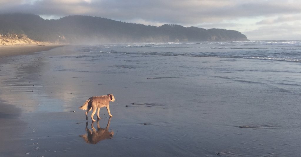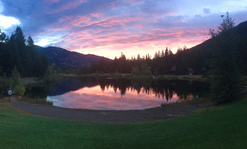
Sunrise at the Freestone
It had been a few years since we had been up to Mazama and the Freestone Inn due to my illness. We had scheduled a trip for last year in September but had to cancel so moved the reservation out as far as we could, a whole year later. Luckily, I was better by this time and we were able to make the trip and get in a lot of hiking.
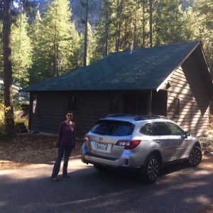
Our home for the next four days
We stayed at a one-bedroom cabin this year instead of our usual studio cabin when we travel alone to the Freestone and it was very nice. Much more space than the studio and the kitchen was large enough to handle both of us cooking which was good. There was also plenty of room for Catherine to do yoga in the mornings and a couch we could read on in the evenings. The small patio had a grill for making dinner.
River Run/Jack’s Trail
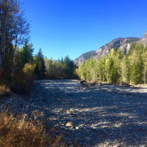
A river doesn’t run through it
The first day we arrived at 3:00 and had dinner reservations at 6:00 since it was my birthday. We unloaded and took off on the Mazama trail planning on linking River Run, Methow Trail, Cassal Cut and Jack’s Trail before dinner. We always forget that this little loop is about 6-6.5 miles and takes longer than you think so we ended up just a bit late for dinner. The scary thing was that the West Fork of the Methow is bone dry above Early Winter’s Creek, I had never seen that before.
We got back to the lodge and had a fantastic dinner in the restaurant looking out at the lake as the sun went down. On the walk back to the cabin we saw a family of deer browsing by the lodge. We crashed since we knew we had a big couple of days ahead of us hiking.
Maple Pass Loop
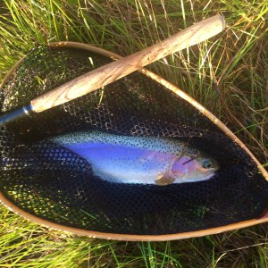 The next morning was COLD. We got up before dawn and I ate breakfast then headed down to the lake to fish a bit while Catherine did yoga. I about froze fishing in the early morning hours. I stuck to tenkara in the morning, fishing my Amago which can handle the big fish in the lake and big fish I did catch. I got about 10 trout that morning including a few big rainbows. I finally headed back to the cabin around 8:30 and by then Catherine was done with breakfast and we hit the road a little after 9.
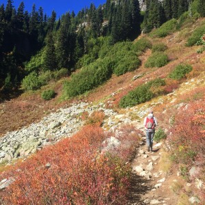 We arrived at Rainy Pass and it was 36 degrees out so we bundled up with everything we had on and hit the trail. It was a crystal clear day and the fall colors hit you as soon as you got on the trail and started climbing up towards Lake Ann. Getting on this trail again was like visiting an old friend, we have done this hike most years we go to Mazama but it had been a while and it just felt good to be back on the trail. As we climbed up towards Heather Pass we encountered ice on the trail, this was the latest in the year we’d done this hike and had never before encountered ice but it wasn’t slippery in too many spots. It is a reminder that this hike may only have a few weeks left.
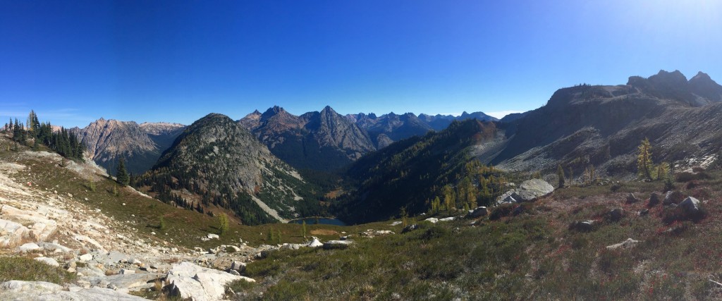
View from Heather Pass looking out over Lake Ann

View other way from Heather Pass – there is still some snow and ice!
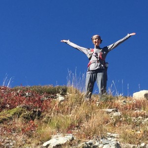
Catherine at Maple Pass
At Heather Pass we stopped for lunch. It was so nice sitting on our rock taking in the views that we really did not want to get up and move again. Finally we packed up and began the ascent up to Maple Pass at 6850′. I always forget how much of a climb it is from Heather Pass to Maple Pass. Once at the top we started our way down the first set of switchbacks on our way to Rainy Lake. The first part is easy but the last part going down the ridge after you spot Rainy Lake is challenging.
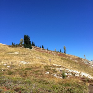 Of course, I had to veer off and climb another steep hill to go find a geocache up on the ridge. That was quite the climb but I found the cache. On the way down that last ridge we ran into a couple that were scanning the Lake Ann bowl with binoculars. We passed them after commenting on the nice day and continued our trek back to level ground and the car.
We stopped by the Mazama Store on the way back to see if we could find a shuttle for the next day. Unfortunately none exists but the guy at the Goat’s Beard told us to try the Cutthroat thru hike to Rainy Pass and hitchhike back since many PCT hikers grab rides from Rainy Pass.
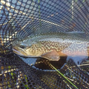
Tiger Trout
After dinner I fished again that evening. I used my 4-weight this time since we had seen fish rising while eating dinner the night before. I managed to land the Freestone Slam – a Rainbow (several rainbows actually), a Brown and a Tiger all on a #20 midge dry fly pattern.
Cutthroat Lake to Rainy Pass
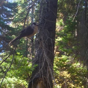
Camp robber
We still weren’t sure about the hike thru on this one and figured we’d start up to Cutthroat Pass and see if we could find a ride from the top in hopes that someone came up from Rainy Pass. Again, Cutthroat is one of our favorite hikes, either to the lake or the pass, and it seemed like visiting another old friend. Just past the cuttoff to the lake we stopped briefly to pull off some clothes before the switchbacks began. In about a minute we were invaded by four camp robbers that were obviously well trained to flock to hikers. We started up the switchbacks and finally climbed our way to the top of the tree line but the pass was still up there, we still had a good climb to hit 6800′.

At the edge of the tree line with the pass above us still
We continued upwards and hit the pass running into a couple of PCT hikers standing at the junction. We chatted with them a bit about their journey from Mexico to almost done with the trail. They were to be the first of many PCT hikers we would encounter the rest of the day. We ate lunch at the pass and were just hanging out when who should appear but the couple we had met the day before on Maple Pass. They were starting down Rainy Pass so we asked if we could get a ride from them and they agreed. Our thru-hike problem was solved thanks to Frank and Betsy who were visiting the area to watch raptors.

Lunch view looking down towards Cutthroat Lake
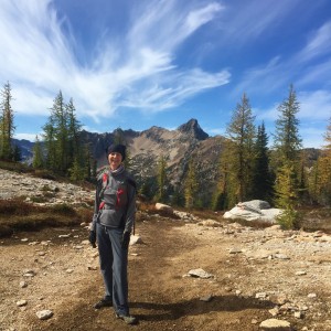 We got our packs on and headed onto the PCT towards Rainy Pass. This trail starts out with postcard views everywhere, it was simply spectacular everywhere you looked. The PCT was a much nicer trail to go down than the Cutthroat Pass trail, very soft and way less rocks, we were so happy to be descending it.
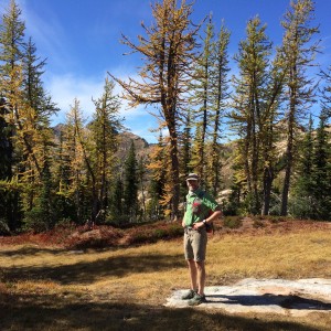 At the edge of the tree line we were again shown the impacts of the drought this year, many evergreens had turned yellowish green or orange and are probably not going to make it. We ran into quite a few PCT hikers on the way down and chatted up a few of them. We talked to people from several countries and got a bit of their story. Alta Lone Peaks appear to be the thru-hiker footwear of choice, I’d say 80% of people we saw were wearing them. Our Arcteryx pack was also popular, one hiker said he felt it was the second most popular pack on the trail aside from the true ultralight packs. Good to know, I guess are already geared up for the PCT if we wanted to tackle that.
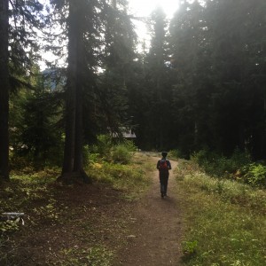
Coming out to the trailhead
After a 5-mile descent we came out to the parking lot at Rainy Pass. We had passed Frank and Betty so we stopped to chat with a few other PCT hikers until they arrived. Once they showed up we got our ride back to our car and were so happy to finally have done this hike as a thru hike after doing each section in the past multiple times but never linking them.
That evening I again went fishing and again slammed with the dry fly.
Pipestone Canyon
On our last morning we awoke to some clouds and the most spectacular sunrise of the trip with the sky turning purple and red over the lake. I fished a bit and again got a bunch of trout early in the morning before heading back to the cabin to load up the car and start our journey home.
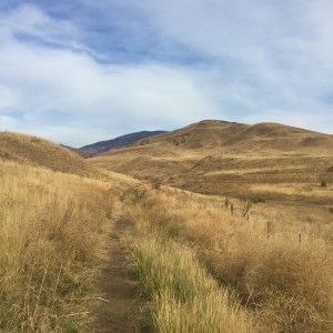 We decided to do a hike on the way home though and do something completely different with the Pipestone Canyon hike. We parked on the south end of the canyon which had us starting out in the desert scrub next to a hay farm. The trail was covered knee deep in places with tumbleweeds so I spent a lot of time trying to clear the trail so the way back wouldn’t be quite as tough. This area had burned last year and all the trees and bushes were black but the grasses obviously had come back.
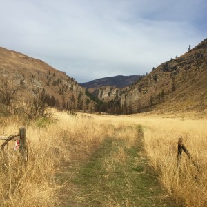 After a little over a mile Pipestone Canyon itself came into view in the distance. You could see that the canyon itself took some fire damage, many trees were blackened though some had survived intact. The last stretch of prairie was longer than it looked, probably another mile until we hit the canyon proper. The funny part was we ran into Frank and Betsy again on the trail, they were scouting kestrels in the valley. The same couple three days in a row on three different hikes.
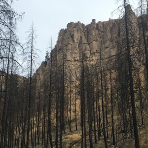
Fire damage and hoodoos
The walls in the canyon are all sandstone hoodoos that are more reminiscent of Bryce Canyon than anything in the North Cascades, it was like we had been transported to a little bit of the southwest. The south end of the canyon had taken the most damage from the fire with most trees totally burned in that area but the underbrush had come back well in places. As we progressed through the canyon more trees were spared and at the north end most of the trees were still green and unburned.

Pipestone Panorama
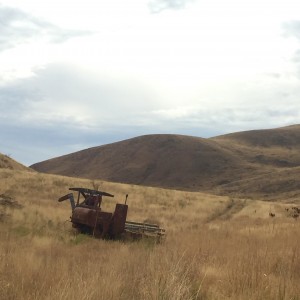 We hung out a bit before starting back down the canyon and into the scrub. We knew we were close when we passed the old combine just a mile or so from the car. What an interesting hike to do, not only do you see rock formations that seem totally out of place but you get to walk through grasses for several miles, much different than our time spent above 6000′ the last few days. Almost at the car a coyote came down the hill and hit the trail right in front of me, I scared the crap out of him and he ran up that hill in a second.
We got back to the car then headed into Twisp to go to the store and gallery there before finally hitting the road and saying goodbye to the Methow for another year. This was one of the best trips we’ve had and it was so good to be back after years of being house bound.

